
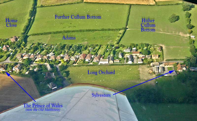
| On the Tithe map of 1847 some 478 fields and
parts of the landscape are named and catalogued. The aerial photograph
above (taken during the August 17th 2001 overflight by us - courtesy
of Peter Bradley) shows the area between the ‘old’ Prince of Wales
and Sylvesters. I have added five of the field names from the Tithe
map; the only change really being the ‘loss’ of part of Adams to provide
land to build the bungalows (1959 to 1963). However, I include a full list of all the names and their reference numbers from the Tithe Book. Where possible I have linked houses to the appropriate parts of the Tithe map - it is not possible to show the whole map (our copy is 4 feet by 3 feet), but I have been able to scan bits of it. Those houses mentioned but not linked are ‘out of range’ on my scans. The map was traced from the original by local resident Sue Clark. If you click on those houses coloured red in the map windows should pop up with photographs of the appropriate houses. To close the pop-up window just click on the picture. |
| The fields are split into blocks of 120 |