| (As these maps need to be quite large to see the proper details, I have put links in this text to take you to the appropriate maps on the page. I hope this makes navigation a bit easier!) |
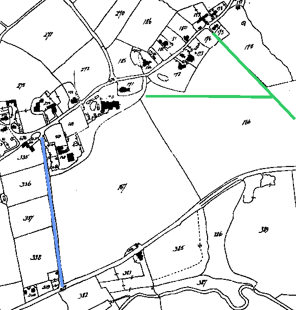
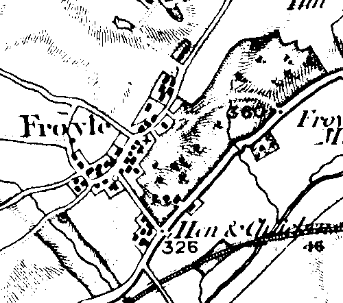
| The Tithe Map of 1847 (above) was actually surveyed in 1845. It shows clearly the Hen & Chicken road (marked in blue), but there is no sign of either Gid Lane or the drive to Froyle Place (I’ve sketched their approximate locations in green). Further refence to the first Ordnance Survey map (below), dated 1817, shows the Hen & Chicken Hill and traces of a track where the drive to Froyle Place should be. |