
Before 1910
The Tithe Map of 1847 has a reference to two Chalk Pits in Lower Froyle which were a valuable source of lime for the fields around the village. One was at the top of Husseys Lane and is, today, known locally as The Dell; the other was near the top of Well Lane, on the left hand side, just below the modern day “Crest Hill Farm”.
The chalkiness of the soil was reflected in some of the field names, especially “White Croft” which would, in later years become The Quarry. We have no mention in the archives of payments for the chalk and it may have been paid for in kind by the farmers using it.
1910
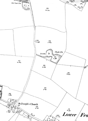
This is the first year we have a map (right) and photograph (bottom) to show the development of “White Croft”. At the top of the map, on the left hand side of Well Lane, you can see the “Old Chalk Pit”, while, just below field 154, you can see the start of the Quarry, labelled “Chalk Pit”. (The map is dated 1910)
Also, in the chalkpit you can see some lime kilns. The lump chalk (limestone) was burnt at temperatures around 1000°C to produce quicklime.
Around this time, with the coming of good road and rail transport, the practice of lime burning was in decline, and only very small amounts were produced for local use.
In the period up to the Second World War, the several chalk pits tended to be used for dumping the village’s rubbish.
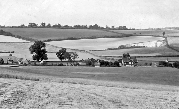
The photograph, taken in 1912 from the slopes of Saintbury Hill, matches well with the map and shows the start of the quarry. Today it stretches up to the treeline on the top of the hill.
World War Two and beyond
On May 14th 1937 the quarry, originally owned by Francis Withers Westbrook, was sold to William Brownjohn, who, on October 22nd 1945 sold it to Daisy Rodway and Marfield Markham.
During the Second World War a radar controlled searchlight had been based in the quarry (see the full story here). This advanced technology required a fairly large contingent to operate and maintain it, and accommodation was built opposite the entrance to the quarry – although, due to the lack of a proper water supply, the troops were obliged to use the facilities at “Oak Cottage”, an event that has gone down in village history!
In the 1970s this accommodation was pulled down the the modern day “Searchlight Cottage” built in its place.
After the war, there was a great impetus to get the country working again, and, in 1947, an Interim Development Order (IDO) was issued by Alton Rural District Council to the Quarry Owners. This order would come back to haunt the village 43 years later.
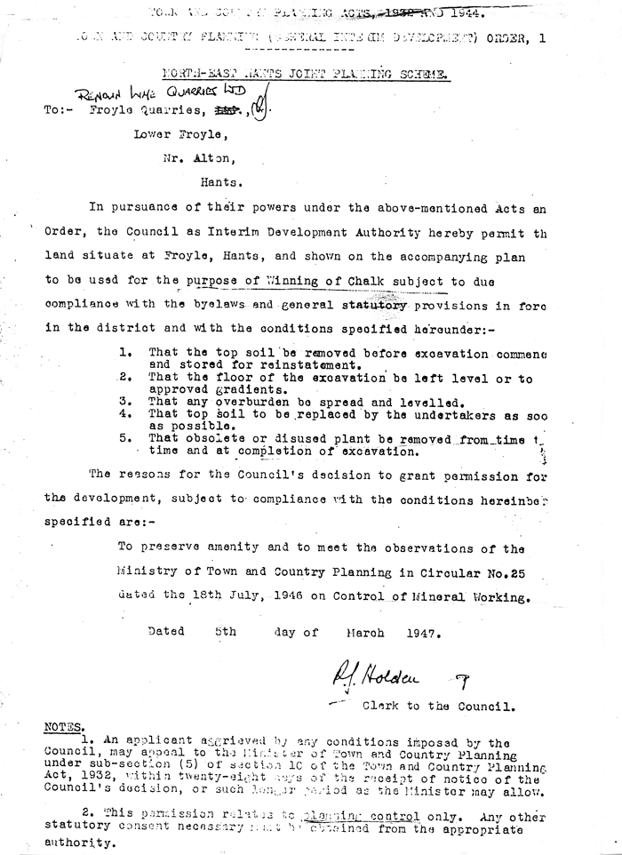
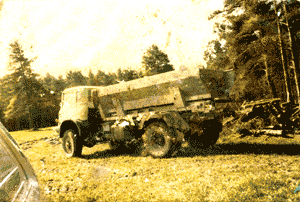
From then on the quarry was operated as per the IDO “…..for the winning of chalk” on a seasonal basis, with relatively small tipper lorries replacing the pre-war farm carts, delivering the chalk to local farmers. There were no washing facilities at the quarry and, in wet weather, Well Lane would become covered in chalk which would spread down the road. However, as there was relatively little activity, two or three lorry loads a day in the chalk spreading season, it was not a major problem.
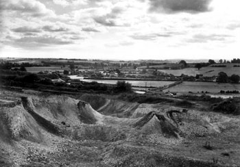
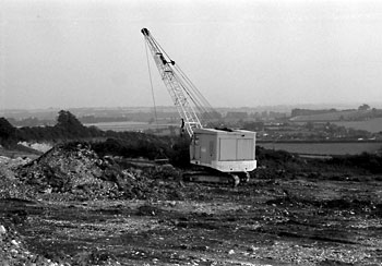
The photograph, left, shows the Quarry in 1961 when the excavation had started to expand towards Well Lane. In 1980, further work was done at the top level and the quarry was deepened, see photograph right.
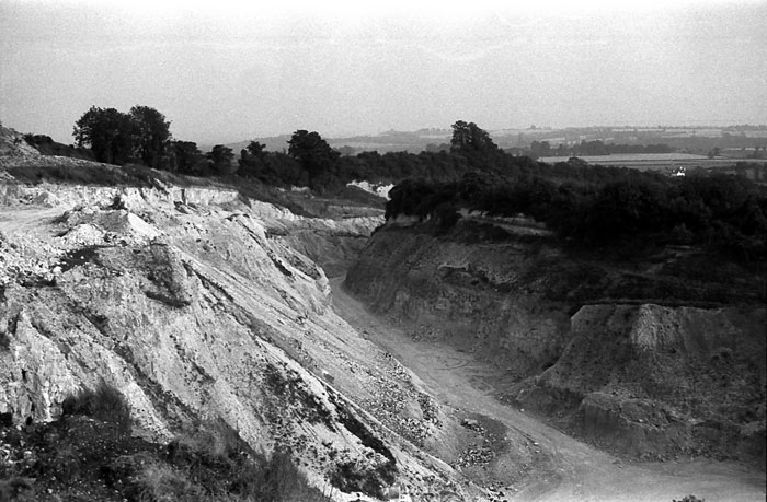
There was an advantage for the village in that, in 1981 and 1982, the Clay Shoot associated with the Village Fête, was held in the Quarry.
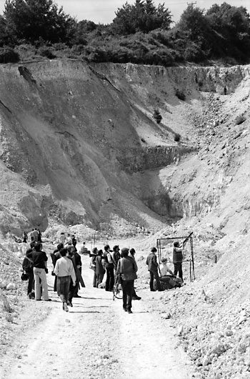
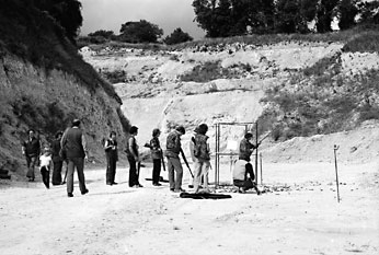
The 1981 photograph (left) shows how deep the quarry had become. The buildings were in an advanced state of decay. (below)
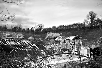
Throughout the 1980s activity at the quarry became less and less, and, around 1989, it was sold to a consortium of three business men from the Bordon area.
1990 onwards
On Thursday, July 6th 1990, the Parish Council conducted its Annual Traffic Survey, recording one lorry and a tractor using Well Lane, besides a few cars.
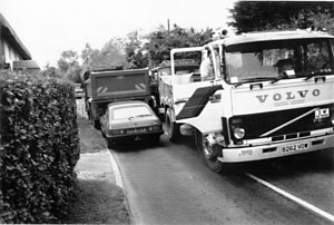
The next morning all hell broke loose, with some 180 lorry movements, using large 8 wheel lorries, which meant that, between 7:30am and 6pm there was, on average, one lorry every three and a half minutes on the road through Lower Froyle. And there was nothing we could do about it!
A sub committee was formed by the Parish Council to investigate the problem and try to obtain a solution.
It quickly became apparent that the 1947 IDO allowed uncontrolled expansion of the site and the activities there connected with the “winning of chalk”. It was also discovered that the IDO had originally been intended to last just long enough for the country to recover post war….. but, when it was drafted, no time limit was put on
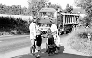
it. The pictures here give some idea of the problems involved with all this extra traffic on very narrow roads. Police and Hampshire County Council tried their best to alleviate the problem – we even had the road through Lower Froyle measured for damage by the County Council, an operation that was fairly costly.
The committee contacted a village in Wales who had suffered the same problem of sudden quarry expansion under an IDO and we exchanged strategies. In addition much use was made of the local papers, radio and television to further our objective of preventing this from wrecking our
village. The initial contract, for the Blackwater Valley Relief Road, lasted until the end of August and was followed by another short one for the extension of the runway at nearby Odiham airfield.
After much research and further contacts through Jean Benson, the Parish Council Chairman, we managed to actually get the law changed and all IDOs in the country were “called in”. However, this meant that, for the next five years, we went through several public enquiries as various limitations were placed on the Quarry owners as to the amount of chalk to be extracted and the hours of working.
Also, during this process, two further ideas to ‘ease’ the extraction of chalk were proposed and maps drawn up!
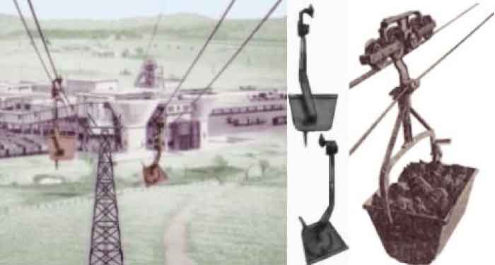
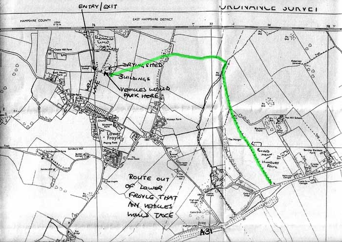
The first was an aerial tramway from the Husseys Lane side of the Quarry, over the skyline crossing Husseys Lane just above Limit Bungalow and heading, via Coldrey, down to the main road.
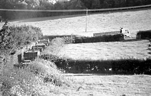
These buckets would carry the chalk to be loaded into lorries somewhere on road to the Bentley side of Coldrey – a similar concept to the picture below.
Following that, the next idea was to build a haul road along the same route so that lorries could avoid passing through Lower Froyle. See the plan below:-
The next move of the owners was to move their skip business there, and, once more we went through another public enquiry!
Nothing came of this and, at the end of the 1990s, the owners tried to sell the quarry to a local Alton Company who wanted to move a satellite ground station that handled business communications from an existing site at Pirbright near Guildford. This was met with strong resistance in the village, and, in late 2001, the company withdrew their application.
Over the previous years, several attempts had been made overtly by villagers to purchase the site, but, the owners refused to sell it.
Another attempt in 2006 to import chalk from road workings on the course of the old Alton to Basingstoke Railway and recycle it, was also turned down.
Happy Ending
In 2012 the quarry site, seen above in a more natural condition in 2008, was finally sold to a private individual who plans to build a house there – the mineral extraction, and its resulting traffic potential, has now gone away for ever.