
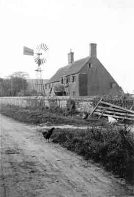
Saintbury Hill forms the dividing ridge between Upper and Lower Froyle.
Saintbury Hill Farmhouse, photographed here in the 1950s when it was an active farm, has appeared in all the Censuses. In 1841 it is just referred to as Saintbury Hill, and this included the farm cottages opposite which have been greatly extended and are today a large family house. In 1851, it was called Saintbury Hill Old Farmhouse – which might indicate it had stood there for some considerable time before the 19th Century – but, in 1861, it is referred to as Simbury Hill Farmhouse, which is very interesting indeed.
Modern theories suggest that the name ‘Saintbury’ is tied in with the naming of Froyle. The late Theo Beck investigated it in depth in his “Facets of Froyle”:-
In “The Place Names of Hampshire” based on the collection of the English Place-Name Society (Richard Coates, B.T, Batsford Ltd. London 1989). Froyle, A difficult name: Ekwall and Gover both toy with the idea that it is O.E. “hill of (the God) Freo/Frig”, which (1) is highly speculative, (2) does not account for the universal o. (3) does not really account for the morphology of the name – one might expect some c.12 form with three syllables, and (4) does not respect the fact that Upper Froyle is at the tip of a rather insignificant ridge and closer to the river Wey than to the more significant ridge to the north of it.
The “Freo/Frig/Frea” connection was suggested to give ‘Saintbury’ as ‘Saint bury’, or the hill where the Saint (Frea) was buried – the name originating from the Nuns of St Mary’s Abbey. However, in 1657 the farm was known as ‘Banburies’, and there had been a Gilbert Bennebury farming there earlier. By 1679 the farm had become Simbury Farm, and in 1760 a James Simbury acted as a witness to a lease drawn up for property in Upper Froyle. So could Saintbury have evolved from the Hampshire dialect of Simbury, and been named after a man who lived there?
Modern pictures from the hill
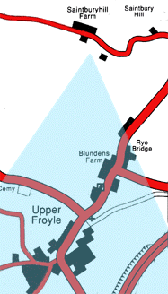
The view below is taken from the public footpath which leads down into Upper Froyle. The white building in the far distance on the right is what was Froyle House, and is today called “The White House”. It is currently the headquarters of the Treloar Trust. We are looking towards the southwest with St Mary’s Church barely visible in the trees in the centre of frame.
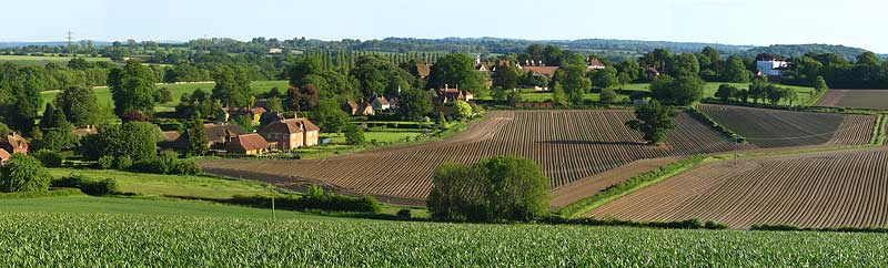
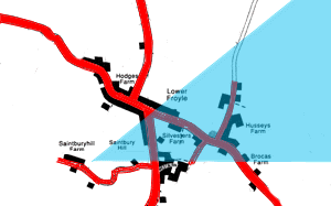
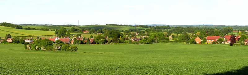
The view below was taken just down the road from Saintburyhill Farm and looks out over Lower Froyle in a south-easterly direction. The green open area in the lower centre of frame is the Recreation Ground, and, beyond it, the village pond and Husseys Lane. The “Prince of Wales” area is just out of shot to the left.
Then and now
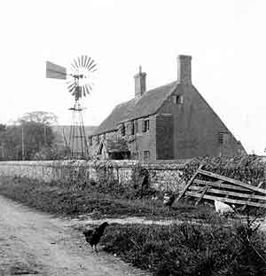
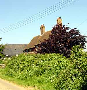
The old photograph was taken in the 1950s when it was an active farm, and the modern picture was taken at the end of May 2001. The farm house is now a private residence. The major differences are fairly apparent:-
- The windpump has gone from the front garden.
- The greenery has grown a bit!
- The road has been made up.
- Electricity has reached the farm.
- The barn in the background has been restored and is used for recreational purposes.